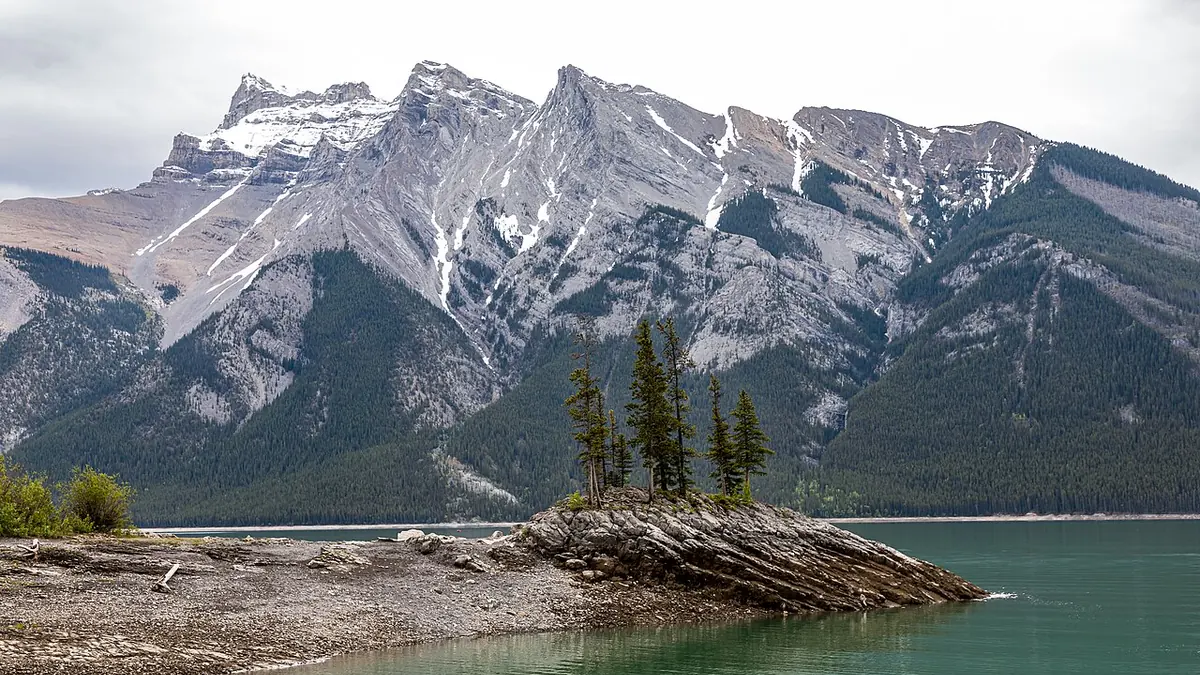
Banff National Park offers turquoise lakes, limestone peaks, glacial valleys, forests, and weather that can redraw a composition within minutes. It also requires more planning than a collection of sunrise coordinates suggests. Popular access systems change, wildlife controls are serious, mountain conditions can close a route, and the most familiar viewpoints are shared with many visitors. A useful photography plan protects time for alternatives while protecting the park.
Parks Canada information checked on 15 August 2026 states that Moraine Lake Road is closed to personal vehicles year-round, with access organized through approved transport and active travel subject to current conditions. Reservations, schedules, road work, seasonal closures, parking restrictions, and area controls can change. Consult Parks Canada's live Banff pages and alerts before departure and on the day of travel. Do not build a dawn plan from an old blog post or map pin.
Organize the trip by landscape type
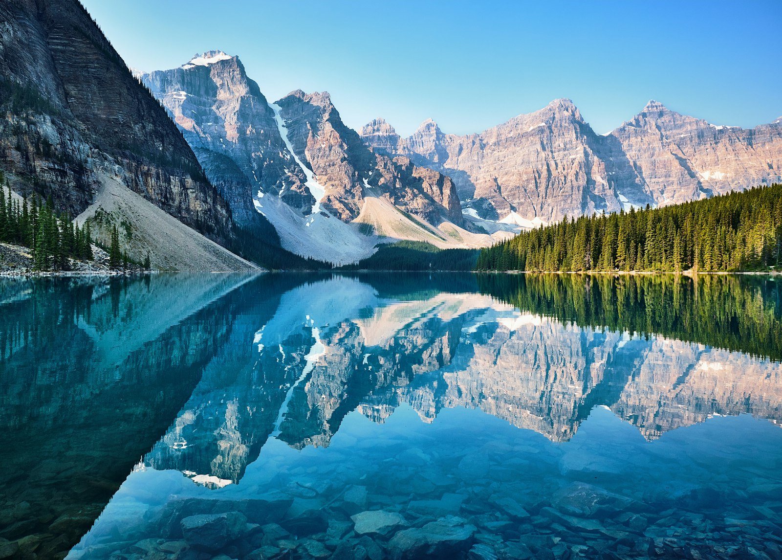
Lake-edge photography depends on wind, shoreline access, mountain orientation, and the ability to work without blocking paths. Reflections are strongest when the surface is calm, but broken reflection can add movement and avoid a postcard duplicate. Elevated viewpoints emphasize valley geometry and scale, while roadside pullouts can support telephoto layers when stopping and standing are lawful.
Forest and river scenes are useful when cloud hides the peaks. Diffuse light can reveal bark, moss, water color, and smaller relationships without extreme contrast. Open alpine or subalpine viewpoints work well for weather, ridge light, and human scale, but they bring greater exposure to wind, temperature change, and wildlife habitat.
Assign one visual question to each session. It might be reflected mountain symmetry, compressed ridges in storm light, a small figure on a durable trail, or glacial water moving through dark trees. Then choose a location category that supports the idea. This makes it easier to move when conditions reject the original viewpoint.
Treat Moraine Lake and Lake Louise as transport projects
Moraine Lake cannot be approached as an ordinary drive-up sunrise location. Current transport eligibility, departure points, reservations, operating dates, bicycle rules, and commercial access must be checked with Parks Canada and the relevant provider. Calculate the first lawful arrival time before promising dawn light. A timetable can be the dominant photographic constraint.
Lake Louise also has active parking and transit management that varies by season and demand. Confirm whether a reservation, shuttle, paid parking, or remote departure is needed for the intended date. Add time for queues, equipment handling, and the walk from drop-off to a legal working position. A tripod setup cannot obstruct the shoreline, path, or another visitor's access.
Prepare a composition that works after direct sunrise color. Reflected peaks, cloud detail, canoes where permitted, shoreline texture, and telephoto studies can remain viable when transport arrives later than ideal. A plan dependent on one minute of alpenglow is fragile when public access is scheduled.
Use the Icefields Parkway as a corridor, not a checklist
The parkway connects many large landscapes, but distance, construction, wildlife, weather, and safe stopping make it unsuitable for rapid viewpoint collecting. Use official road conditions and closure information. Select a small geographic cluster for a day and identify legal pullouts before travel. Never stop in a traffic lane or stand beyond a barrier for a clearer angle.
Longer focal lengths are especially useful along broad valleys. They can isolate a sunlit face, overlapping ridge, waterfall, or weather front without pushing the foreground into the frame. A standard lens can retain a natural scale, while a wide lens should be reserved for a foreground that contributes structure rather than merely filling space.
Weather often creates the photograph. Rain shafts, snow on high ground, low cloud, and isolated light can be more distinctive than a clear blue sky. Keep the camera protected and work from safe established positions. If visibility makes driving uncertain, the assignment stops until travel is safe.
Choose seasons by conditions, not color labels
Season affects road access, daylight, water state, snow, fire and smoke risk, crowd patterns, wildlife behavior, and suitable equipment. Spring at valley level can coexist with winter conditions higher up. Summer can provide long days but also busy access and rapidly changing mountain weather. Autumn color is brief and elevation-dependent. Winter creates clean forms and ice, while adding severe cold, short daylight, avalanche terrain, and road risk.
Do not publish or rely on exact bloom, larch, freeze, thaw, or ice dates far in advance. Monitor current observations from accountable local sources and keep the itinerary flexible. A year with smoke, drought, heavy snow, or unusual temperature can shift both access and appearance.
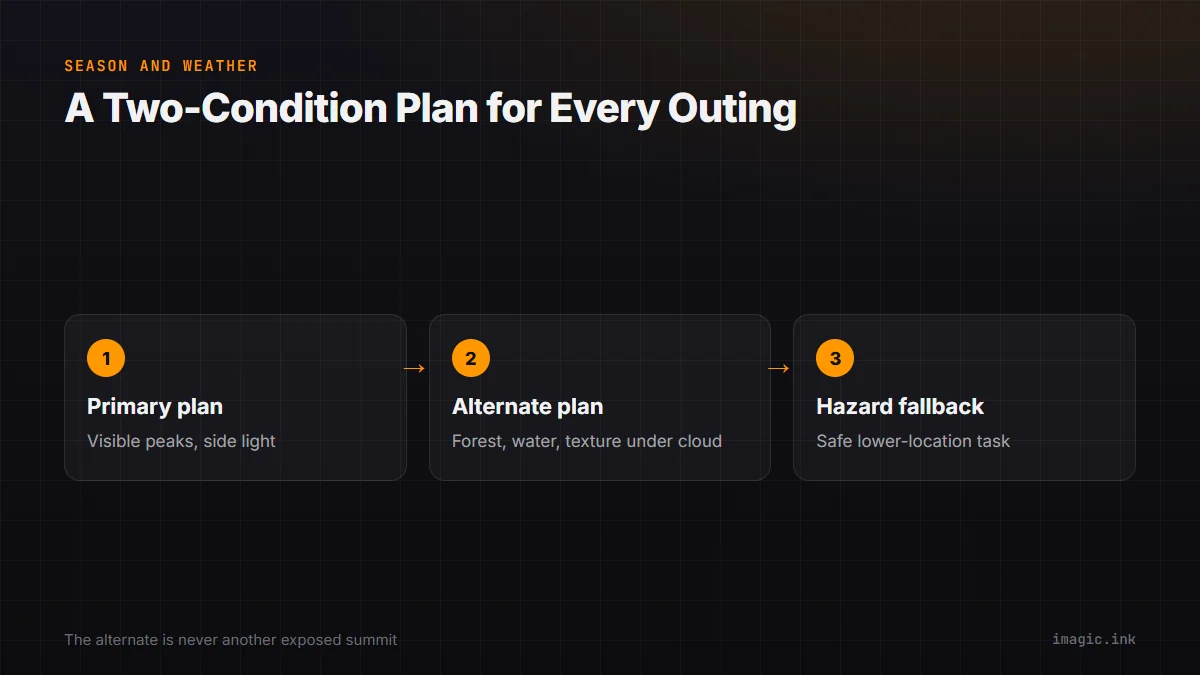
Use a two-condition plan for every outing. The primary plan may need visible peaks and side light. The alternate should work under cloud, such as forest detail, water, texture, or a closer subject. If conditions become hazardous, the alternate is not another exposed summit; it is a safe lower-location or non-field task.
Pack for rapid mountain changes
A landscape kit should include weather protection for camera and pack, insulating layers, rain shell, navigation independent of reception, headlamp, water, food, and the safety equipment appropriate to the route. Spare batteries should be kept dry and reasonably warm. Cold reduces practical battery performance, but avoid unsupported claims about a fixed percentage or duration.
Choose lenses from the session plan. A wide or standard zoom covers environmental compositions, while a telephoto handles ridge separation and wildlife observed from a lawful distance. A sturdy tripod helps in low light, but it should not be opened across a busy path or on fragile ground. A polarizer can control glare, yet its effect varies across a wide sky and it can remove reflections that carry the image.
Carry a simple cleaning kit for spray, dust, and snow. Change lenses in shelter when possible. Keep equipment attached or packed around crowded viewpoints, buses, and boats. The objective is not maximal gear; it is a system that can be moved safely without leaving pieces across a public site.
Expose glacial water and bright peaks deliberately
Glacial lakes can appear intensely colored because of suspended material and light, but color changes with angle, weather, depth, and reflection. Do not force every frame toward the same saturated turquoise. Protect important highlight texture in snow, cloud, and lit rock, then decide how much shadow detail supports the scene.
Check individual color channels when sunrise or sunset becomes saturated. A combined histogram can conceal a clipped channel. Bracket only when the scene exceeds the useful range of one RAW file or when a blend is planned. Capture a single base frame because moving water, trees, boats, and people can make a bracket merge difficult.
For reflection, focus and depth should include the relevant shoreline and mountain, not necessarily every pebble at the tripod feet. If a close foreground is essential, compare a carefully focused single exposure with a stack, while accounting for moving plants and water. At long focal lengths, haze and heat movement can limit distant clarity; waiting for a cleaner interval may help more than extra sharpening.
Photograph wildlife without changing its behavior
Parks Canada sets minimum distances and may establish closures or additional restrictions. The current rules for each species and area must be followed. A long lens does not grant permission to leave a vehicle, approach, surround, call, feed, or block an animal. If wildlife reacts to the photographer, the interaction is already too intrusive.
Traffic safety comes first during roadside sightings. Stop only where lawful and fully clear of the road, remain inside the vehicle when directed, and do not contribute to a wildlife jam. Keep food and scented items secured according to park guidance. Report relevant hazards through official channels rather than moving closer for documentation.
Wildlife is not a prop for the landscape. A distant animal can establish scale and habitat without becoming a tight portrait. If safe distance makes the subject small, accept the environmental composition or put the camera down.
Back up a multi-day mountain take
At the end of each field block, copy cards to a clear day-and-camera folder, verify the transfer, and create an independent second copy. Keep cards unformatted until both copies are confirmed. Store copies separately during travel when practical. Do not use a cloud upload as the only backup in accommodation with uncertain bandwidth.
Preserve panoramas, brackets, focus stacks, and long-exposure variations as sequences. Record location broadly enough to support editing while respecting sensitive wildlife and site information. Add a field note for unusual weather, access, filter use, or frames that depend on a blend. These notes reduce guesswork weeks later.
imagic can scan a copied directory and locally analyze sharpness, exposure, composition, closed eyes where applicable, and near-duplicate or burst groups. Culling sets reversible status rather than deleting files. This can shorten navigation through repeated lake and weather sequences, but the photographer still chooses the frame whose atmosphere and story matter. See the desktop workflow and the Destinations and Guides section for related planning.
Edit for a coherent mountain story
A Banff set needs more than broad views. Include arrival, trail or transport context, weather, water detail, forest structure, human scale where consent permits, and transitions between locations. Compare similar lake frames for cloud shape, wind, shoreline edges, and balance, then choose one lead. Repetition weakens the singular frame.
Keep color relationships believable across changing altitude and weather. A warm summit can coexist with cool shade, but global warming that neutralizes every blue shadow may flatten the light. Apply local contrast carefully around mountain edges and reflective water. Avoid processing that turns smoke, haze, or distant atmosphere into hard halos.
Finish with a factual caption check. Name only locations that are confirmed, avoid exposing sensitive wildlife positions, and distinguish a seasonal observation from a permanent access rule. The strongest guide to Banff is a sequence that communicates scale and conditions without encouraging unsafe or prohibited imitation.
Plan communications and a conservative return
Cell coverage is not a dependable mountain safety system. Leave a route, transport plan, check-in time, and overdue action with a responsible person. Carry navigation and communication appropriate to the outing, understand who manages the area, and know how current emergency guidance says to request help. A satellite device is useful only when it is charged, configured, and understood.
Set the turnaround point from remaining daylight, weather, route condition, and the slowest person, not from the possibility of a stronger sunset. Transport reservations and last departures can impose a hard deadline. Write them on the field card and keep a lower-risk composition near the exit so the final photograph does not depend on delaying a safe return.
Frequently asked questions
Can a private car drive to Moraine Lake?
Parks Canada currently states that Moraine Lake Road is closed to personal vehicles year-round. Check the official page for current shuttle, approved transport, cycling, and seasonal access details.
What lens is most useful for Banff landscapes?
A standard or wide option covers environmental scenes, while a telephoto is valuable for ridge layers and lawful wildlife distance. Choose from the planned composition rather than carrying every focal length.
Is cloud cover a reason to cancel a Banff photography day?
Not automatically. Cloud can support forests, rivers, details, mist, and isolated light, but hazardous weather or unsafe travel is a reason to stop. Maintain a safe lower-altitude alternative.